


The Larapinta Trail is 223kms long and is a world class walking trail that starts at the Alice Springs Telegraph Station and ends at the top of Mount Sonder. It’s in the rugged beauty of the MacDonnell Ranges and is the ultimate adventure for anyone who wants to get off the beaten track and experience the Australian outback.
Walking the Entire Larapinta Trail
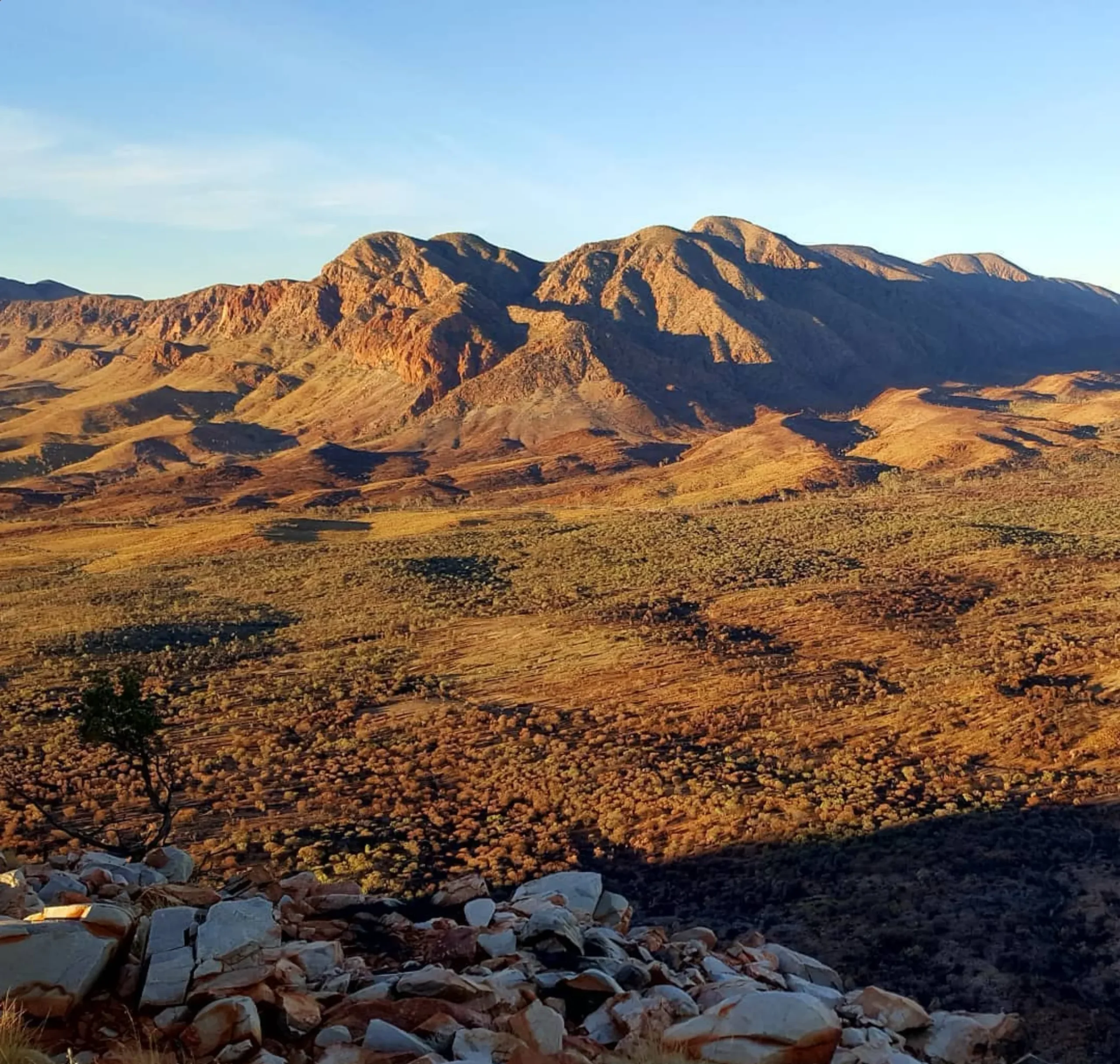
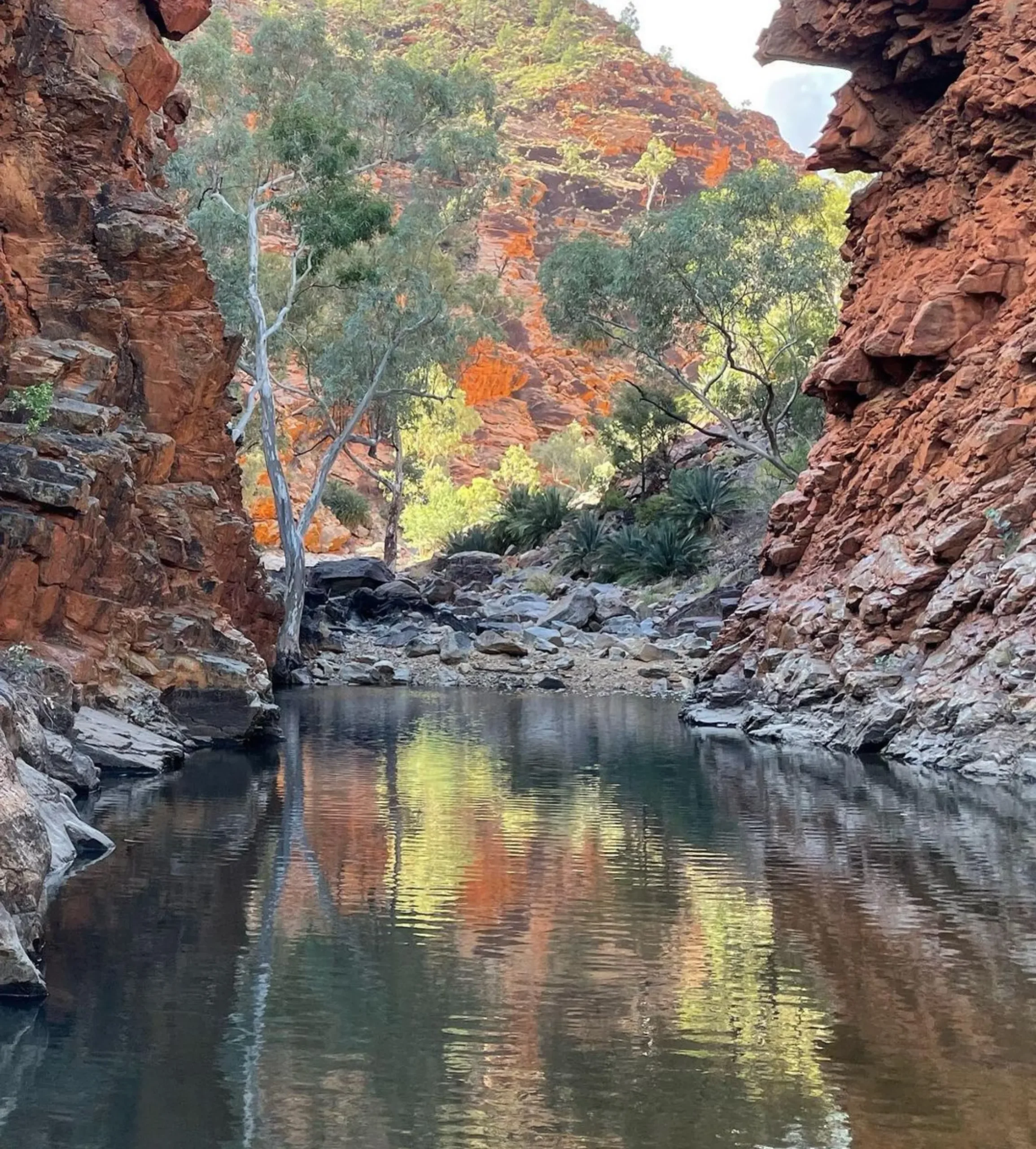
The Larapinta Trail is divided into 12 sections, each with its own highlights. From sheltered gorges like Serpentine Gorge to views at Hilltop Lookout, every step is a surprise. The trail has creek beds, rock walls, ridge lines like Razorback Ridge and so much more.
Individual Sections of the Larapinta Trail
Each section of the trail is different in length and difficulty so there’s something for all levels of walkers. Here are some of the sections and their highlights:
- Section 1: Alice Springs Telegraph Station to Simpsons Gap (24 km) Start at the Alice Springs Telegraph Station and walk past Euro Ridge, Alice Valley and Ghost Gum Flat.
- Section 4: Standley Chasm to Jay Creek (17.7 km) Millers Flat, Fringe Lily Creek, Rocky Gully.
- Section 7: Serpentine Gorge to Ormiston Gorge (28.6 km) Inarlanga Pass, Waterfall Gorge, Razorback Ridge with views.
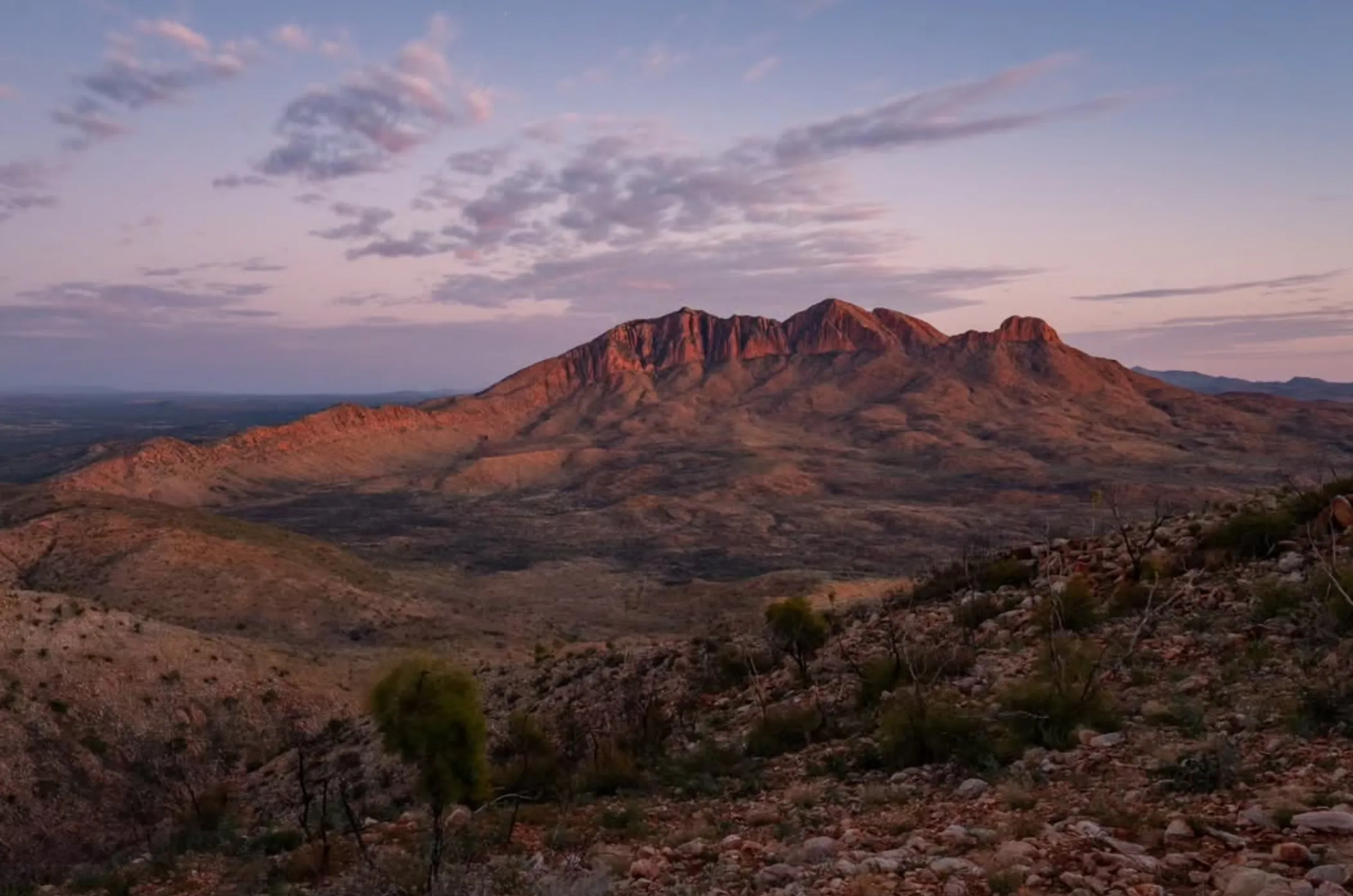
- Section 12: Redbank Gorge to Mount Sonder (16 km) Finish your adventure with a sunrise hike to the top of Mount Sonder for views of the Heavitree Range.
Trail Experience: Highlights
Natural Attractions
The Larapinta tours has many highlights:
- Ormiston Gorge: Rock walls and permanent waterholes.
- Ellery Creek Big Hole: A swimming hole with igneous rock formations.
- Hugh Gorge and Spencer Gorge: NT ruggedness.
- Simpsons Gap: Rock walls and wildflowers.
Cultural
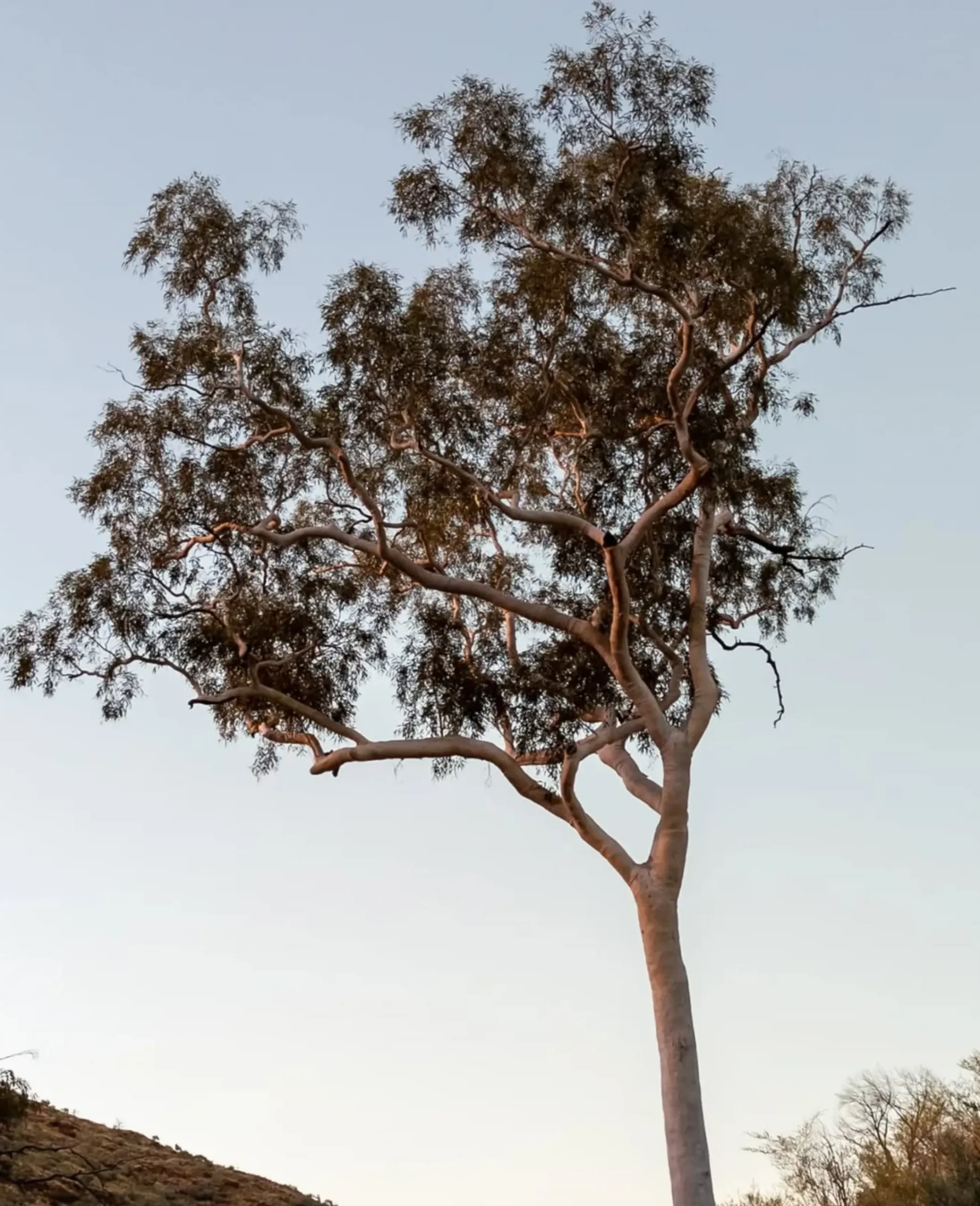
The trail passes through Arrernte country and gives insight into their culture and connection to the land.
Planning Your Adventure
Hike the Whole Trail
It takes 12-20 days to complete the whole trail depending on your fitness level, trail conditions and time constraints. If you can’t do the whole trail you can hike a couple of sections or join guided Larapinta Trail tours.
Key Stuff to Bring
- Food and Water: Use Larapinta Food Drops to lighten your pack. Pre arranged food boxes at trail heads like Glen Helen Gorge or Ellery Creek South will keep you supplied.
- Gear: Bring a rain jacket, day pack, camping gear and muesli bars for energy.
- Navigation and Safety: Many sections have no phone reception so bring maps and a GPS. Let authorities know your itinerary.
Accommodation
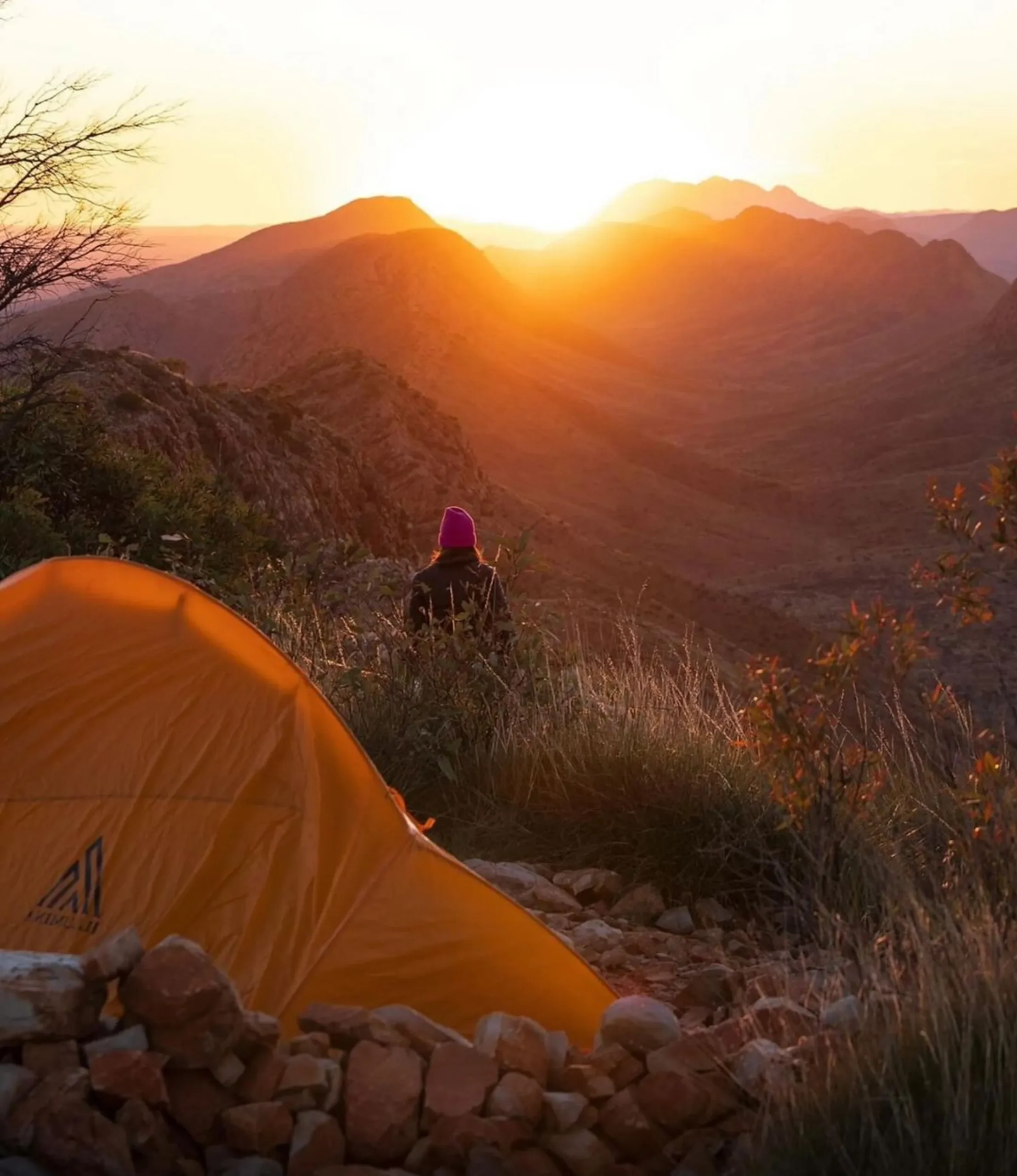
The trail has many camping spots, from basic Mulga Camp to more comfortable Eco-Comfort camps with facilities like rainwater tanks, picnic tables and gas barbecues.
Food Budget and Supplies
Plan for dehydrated meals or use a food dehydrator to manage your food budget. Food caches and food bags at food drop locations are highly recommended.
Challenges and Perks of the Trail
Trail Grade
The trail is Grade 3 (moderate walk) to Grade 4 (difficult trails) with sections like Razorback Ridge challenging even the most experienced hikers. The terrain includes rocky paths, steep climbs and long stretches through river beds and creek beds.
Fitness Level and Rest Days
While the trail is suitable for fit hikers, even experienced trekkers need rest days to recover and enjoy the views. Key attractions like Hilltop Lookout and Ormiston Gorge are perfect places to take a break.
Weather and Seasons
Best time to hike is April to September with daytime temperatures 20-25 degrees. Don’t hike in summer as it’s too wet and hot.
Tips for Hikers
- Bring Drinking Water: Use water tanks along the trail and treat all water sources.
- Pack Light: Lighten your pack to avoid strain on long hikes.
- Allow Plenty of Time: Each section deserves time to explore so factor in hours per day for walking and resting.
- Stay Prepared for Emergencies: Always pack a rain jacket, first aid kit, and enough supplies for unexpected delays.
Conclusion
The Larapinta Trail Trip is more than 223kms. It’s a journey through ancient landscapes, amazing ridges and permanent waterholes. From the Finke River to the views of Mount Sonder every km is an adventure that will leave a lasting impression. If you’re heading to the area consider combining your Larapinta Trail tour experience with Kings Canyon, Finke Gorge National Park or Uluru-Kata Tjuta National Park for the ultimate outback adventure. Autopia Tours have packages that will make exploring these amazing places easy and stress free.
FAQs
How long is the Larapinta Trail?
223kms, 12 sections
How hard is the trail?
Grade 3 (moderate) to Grade 4 (difficult) suitable for moderately fit to experienced hikers
What are the highlights?
Simpsons Gap, Ormiston Gorge, Ellery Creek Big Hole, Redbank Gorge
Can I do it independently?
Yes, independent hikers can self trek using Larapinta Trail Trek Support, food drops and camping fees for designated sites.
What’s the best time to hike the Larapinta Trail?
The cooler months from April to September are ideal, with pleasant temperatures and less rain.